Ecuador and Peru
Ecuador
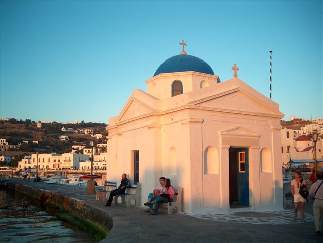
Quito - What a magnificent city!
Quito is the capital city of Ecuador, and at an elevation of 9,350 feet above sea level, it is the highest official capital city in the world. It is located in South America Ecuador in the Guayllabamba river basin, on the eastern slopes of Pichincha, an active volcano in the Andes mountains. With a population of 2,671,191 according to the last census (2014), Quito is the second most populous city in Ecuador.
The historic center of Quito has one of the largest, least-altered and best-preserved historic centers in the Americas. Quito, along with Kraków, were the first World Cultural Heritage Sites declared by UNESCO in 1978. The central square of Quito is located about 25 kilometers (16 mi) south of the equator; the city itself extends to within about 1 kilometer (0.62 mi) of zero latitude. A monument and museum marking the general location of the equator is known locally as la mitad del mundo (the middle of the world), to avoid confusion, as the word ecuador is Spanish for equator.
 |
| Quito Cathedral |
 |
| Colonial Quito |
 |
| View from the top - at the TelefériQo - cable car |
 |
| Housing |
 |
| Basilica - to the left of this image |
 |
| Quito Basilica |

 |
| TelefériQo - cable car - 12,934 feet — in Quito - A view of the hiking trail near the summit. |
 |
| Quito street |
 |
| For sale |
 | |
| Plaza Foch - restaurant and entertainment area |
Mitad del Mundo (Middle of the World)


Otavalo, Cotachachi and Papallacta Ecuador


 Termas de Papallacta
Ecuadorian Amazon
Our beautiful jungle resort was on the Napo River near Ahuano,
Ecuador. At the port of Tena long boats were boarded to transport us to a resort. Our days were spent hiking and exploring the jungle. On our expeditions "jungle
gear" was required which meant long pants, long sleeve shirts, rubber boots, bug
spray, sunscreen, rain ponchos and plenty of water. It was a hot and sweaty time but when the rain did fall it
was perfectly refreshing.


The view after a long hike in the rain! Well worth it.

 Not far from the middle of the world but a long way from everything else.
 The
city is also a Roman Catholic religious center, as some Catholic
believers say that the Virgin Mary appeared nearby a waterfall. So a
sculpture of the virgin, called Virgen de Agua Santa, was placed in this
cathedral.
The
city is also a Roman Catholic religious center, as some Catholic
believers say that the Virgin Mary appeared nearby a waterfall. So a
sculpture of the virgin, called Virgen de Agua Santa, was placed in this
cathedral.


Banos, Ecuador
Banos
is a beautiful city. People come here for the beauty of the
surrounding area including a volcano and the waterfall El Paílón del
Diablo. The history of the town is linked with the highly active
Tungurahua volcano. In October 1999, all 17000 + residents were forced
to evacuate the city for weeks.
Banos is a center for Adventure Tourism.
 Paílón del Diablo - near the waterfall
 Paílón del Diablo - I tasted this green fruit - very sour and served with salt. It is called Jocote. http://en.wikipedia.org/
 Paílón del Diablo — in Baños, Tungurahua, Ecuador.


 Hacienda Manteles
 Hacienda Manteles

 At a nearby market
 Spinning yarn and selling guinea pig food.
 Hacienda La Cienega

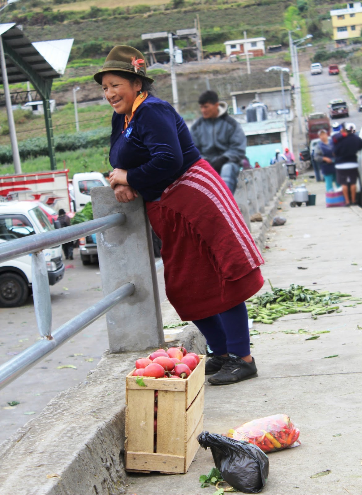
Ecuadorian Market
What a privilege visiting a rural market!
Hacienda Manteles, Banos & Hacienda La Cienega
We
had an amazing stay at Hacienda Manteles which had the most beautiful
grounds imaginable. The following day we enjoyed lunch at the Hacienda
La Cienega, one of the oldest and most historical haciendas in Ecuador,
belonging to the descendants of Marques of Maenza dating back to the
17th century, with spectacular views to the Cotopaxi National Park and
volcano.
Hacienda La Cienega
 Art in El Ejido Park
 El Ejido Park


 Old with new.
 At the airport - roses can be shipped home.
Last Days in Beautiful Quito
At the airport - roses can be shipped home.Off to Peru
Lima
Lima is a beautiful city on the Pacific Ocean. It has a population of 8 million people. The Historic Centre of Lima was declared a UNESCO World Heritage Site in 1988. The architecture is colonial.


Urubamba Sacred Valley


Urubamba Market
Urubamba
is a small town in Peru, located near the Urubamba River under the
snow-capped mountain Ch'iqun. Located one hour from Cusco, Urubamba is
the largest town in the Sacred Valley of the Incas. It is also located
near a number of significant ruins of the Inca Empire, including Machu
Picchu. There is a popular market selling fresh fruit and vegetables and
also pots, pans, and other essential items. The market does not really
cater to tourists. These images are from this market.


Maras and Moray, Peru
Moray
is an impressive agricultural center that demonstrates the ancient
Incan’s mastery of high-altitude crop growing. There is a large complex
of terraced circular depressions in the earth which historians believe
were used to study the climatic conditions on crops. When you descend
each layer, the surrounding temperature descends as well, degree by
degree, making for a unique and highly sophisticated thermo graphic
tool.
Maras is a colonial town known for its nearby salt evaporation ponds in use since the time of the Incas.
Maras is a colonial town known for its nearby salt evaporation ponds in use since the time of the Incas.


The salt pools are traditionally allotted to the citizens of Maras wishing to harvest salt. Usually there are many unused salt pools available to be farmed. Any prospective salt farmer needs only locate an empty currently unmaintained pond, consult with the local informal cooperative, learn how to keep a pond properly within the accepted communal system, and start working.


Machu Picchu
It
is believed that Machu Picchu was built as an estate for the Inca
emperor Pachacuti. The Incas inhabited it around 1450, but abandoned it a century
later. It was brought to international attention in 1911 by the American
historian Hiram Bingham. Machu Picchu was declared a Peruvian
Historical Sanctuary in 1981 and a UNESCO World Heritage Site in 1983.
In 2007, Machu Picchu was voted one of the New Seven Wonders of the
World. It was built in the classical Inca style, with polished dry-stone
walls. Machu Picchu is vulnerable to earthquakes.

 We
took the train from Urubamba. The ride was about 1.5 hours. The cost
for the Vista Dome train in high season is $150 USD return.
We
took the train from Urubamba. The ride was about 1.5 hours. The cost
for the Vista Dome train in high season is $150 USD return.


Cusco
Cusco or Cuzco is a city in the Andes mountains and has a population of 435,114. It's elevation is around 3,400 m (11,200 ft). Cusco was the site of the historic capital of the Inca Empire and was declared a World Heritage Site in 1983 by UNESCO. Because of its antiquity and importance, the city center retains many
buildings, plazas, streets and churches of pre-Columbian times and
colonial buildings, which led to his being declared a World Heritage
Site by UNESCO in 1983.


Convent of La Merced.


Cusco
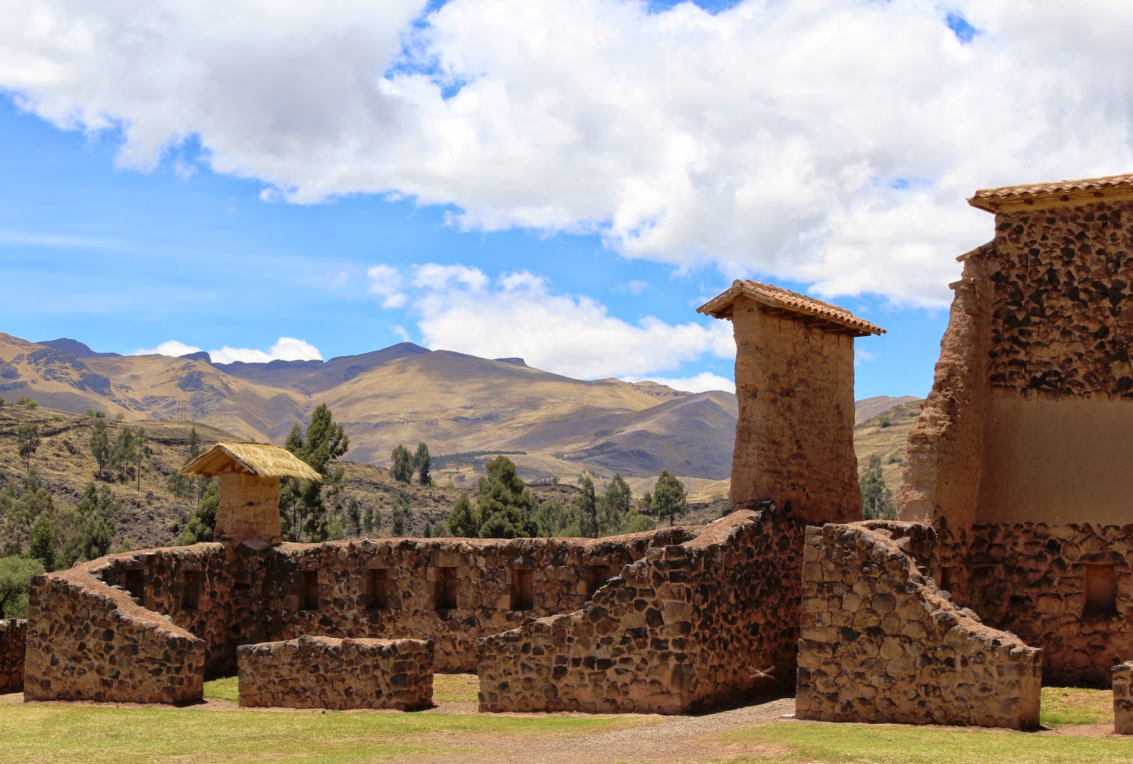
 Raqch'i
 Traditional lady at Raqch'i
 Traditional lady at Raqch'i
 Raqch'i - Temple of Wiracocha
 Raqch'i
 Raqch'i - Temple of Wiracocha
 Raqch'i

 Paddington Bear at Raquch'i. Maybe he is found his home in deepest, darkest Peru!


 Weaving at Raqch'i.
 The train to Lake Titicaca
 Highest elevation of our journey over 14,222 ft. Regional border of Cusco - Peru.
 Taking the Alpaca for a walk! — at Regional border of Cusco - Peru.
 Near Puno, Peru. La Raya Pass

 Train to Titicaca!
 Train to Titicaca!


 Traditional braids
 La Raya Pass
 2 hours from Puno
 Torito
de Pucara, they are placed on the roof for good luck, fertility (of
crops and livestock) and to bring prosperity. They are typically given
as presents for extra luck and pretty much every building you see in
southern Peru has one of the decorations on its roof.
Torito
de Pucara, they are placed on the roof for good luck, fertility (of
crops and livestock) and to bring prosperity. They are typically given
as presents for extra luck and pretty much every building you see in
southern Peru has one of the decorations on its roof.
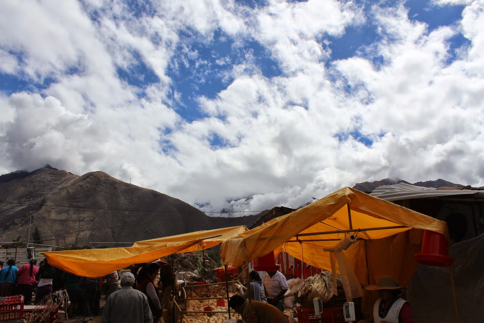
 Pucara
 Pucara, Peru
 Delicious cheese! — in Pucará, Cajamarca, Peru.
Raqch'i and Pucara
Raqch'i
is an Inca archaeological site in Peru located in the Cusco Region It
is 3480 meters above sea level and 110 kilometers from the city of
Cuzco. It also known as the Temple of Wiracocha, one of its
constituents. The town of Pucará is located on the main highway that
runs between Puno and Cuzco, 80 kms (50 miles) northwest of the shores
of Lake Titicaca and at the breathtaking elevation of about 3900 masl
(almost 13,000 feet). It is a small town of between 1500-2000
inhabitants that is known across Peru for the archaeological site of
Pukara and a vibrant modern pottery-making tradition. It is estimated
that 80% of Pucareños are potters, in addition to growing high elevation
crops and raising a variety of livestock.


Puno and Lake Titicaca
Puno
is a city in southeastern Peru, located on the shore of Lake Titicaca.
It has a population of approximately 149,000. The city was established
in 1668. Due to the high elevation (12,556 ft) the average annual
temperature is about 15 °C. In winter (July and August) the night time
temperatures often drop well below zero.
Lake Titicaca is in the Andes on the border of Peru and Bolivia. It is often called the highest navigable lake in the world, with a surface elevation of 3,812 meters (12,507 ft). This refers to navigation by large boats.
On Lake Titicaca a population of people live on the Uros which is a group of 44 artificial islands made of floating reeds (totora, a reed that grows abundantly in the shallow water of the lake). Their original purpose of the islands was defensive, and they could be moved if a threat arose.


 Floating Islands- A convenience store pulls up. They jokingly call it "Floating WalMart".
 The
islands have a base constructed of the compact roots and soil of the
totora which is a floating reed. These blocks are tied together with a
nylon rope. Piles of reeds are put on top. As the island sinks more
reeds are laid on top. An island lasts about 10 years before it has to
be rebuilt. It has a depth of 6 - 7 feet. When you walk on it is feels
like a large water bed. The children go to school on one island. There
are also 3 churches and some other services.
The
islands have a base constructed of the compact roots and soil of the
totora which is a floating reed. These blocks are tied together with a
nylon rope. Piles of reeds are put on top. As the island sinks more
reeds are laid on top. An island lasts about 10 years before it has to
be rebuilt. It has a depth of 6 - 7 feet. When you walk on it is feels
like a large water bed. The children go to school on one island. There
are also 3 churches and some other services.
 Transportation — at Uros Floating Islands, Lake Titicaca, Peru.


 Reed rafts


 Puno
Puno
 Puno
Puno
 Puno
Puno
 Puno
Puno
 Puno
Puno
Lake Titicaca is in the Andes on the border of Peru and Bolivia. It is often called the highest navigable lake in the world, with a surface elevation of 3,812 meters (12,507 ft). This refers to navigation by large boats.
On Lake Titicaca a population of people live on the Uros which is a group of 44 artificial islands made of floating reeds (totora, a reed that grows abundantly in the shallow water of the lake). Their original purpose of the islands was defensive, and they could be moved if a threat arose.
Last Few Days In Lima
Well
this is the end of my "travelog" to Peru and Ecuador. We stayed in a
lovely bed and breakfast in a residential area of Miraflores (which is a
district in Lima). The Huaca Pucllana which is an adobe clay pyramid
built around 200 AD. Time spent strolling the residential streets,
shopping at the outdoor Miraflores shopping center, people watching at
El Parque Del Amor,
and visiting the Miraflores Pier. Another highlight was exploring the
inspiring and beautiful Larco Museum. And finally a visit to The Magic
Circuit Water Park did not disappoint.
 Fog in Miraflores!

 Larco Museum - gardens
 The
Larco Museum is housed in an 18th century vice royalty-era mansion and
is surrounded by beautiful gardens.The galleries provide captivating
narrative accounts of more than 5000 years of pre-Columbian Peruvian
history.
The
Larco Museum is housed in an 18th century vice royalty-era mansion and
is surrounded by beautiful gardens.The galleries provide captivating
narrative accounts of more than 5000 years of pre-Columbian Peruvian
history.
 The
Love Park is entirely dedicated to all lovers and offers a stunning
view over the bay of Lima. It's really romantic here at sunrise and
sunset. The surrounding walls are artfully decorated with mosaics. In
the center of Parque del Amor you find the statue "El Beso" (The Kiss)
from Victor Delfín. It shows two lovers united in an intimate kiss.
The
Love Park is entirely dedicated to all lovers and offers a stunning
view over the bay of Lima. It's really romantic here at sunrise and
sunset. The surrounding walls are artfully decorated with mosaics. In
the center of Parque del Amor you find the statue "El Beso" (The Kiss)
from Victor Delfín. It shows two lovers united in an intimate kiss.
 The
Huaca Pucllana is an adobe and clay pyramid located in the Miraflores
district of central Lima, Peru, built from seven staggered platforms. It
takes its name from the Quechua word “pucllay,” meaning “game,” which
in its entirety can be translated as “a place for ritual games.” It
served as an important ceremonial and administrative center for the
advancement of the Lima Culture, a society which developed in the Peruvian Central Coast between the years of 200 AD and 700 AD.
The
Huaca Pucllana is an adobe and clay pyramid located in the Miraflores
district of central Lima, Peru, built from seven staggered platforms. It
takes its name from the Quechua word “pucllay,” meaning “game,” which
in its entirety can be translated as “a place for ritual games.” It
served as an important ceremonial and administrative center for the
advancement of the Lima Culture, a society which developed in the Peruvian Central Coast between the years of 200 AD and 700 AD.
 Huaca Pucllana
 Miraflores Pier
 Since
2007 a water and light show called the The Magic Water Circuit was
developed. The park has the Guinness Book record for the largest
fountain complex in the world, displaying 13 distinct fountains and many
are interactive. All of the fountains are illuminated at night, many
with continuously changing colour schemes. A colourful laser light
program synchronized with classical and Peruvian music makes the
fountains sparkle and shine as the water flows in unique patterns and
shapes. — at Water Magic Circuit.
Since
2007 a water and light show called the The Magic Water Circuit was
developed. The park has the Guinness Book record for the largest
fountain complex in the world, displaying 13 distinct fountains and many
are interactive. All of the fountains are illuminated at night, many
with continuously changing colour schemes. A colourful laser light
program synchronized with classical and Peruvian music makes the
fountains sparkle and shine as the water flows in unique patterns and
shapes. — at Water Magic Circuit.
 The Magic Water Circuit
 Virgen Milagrosa Church
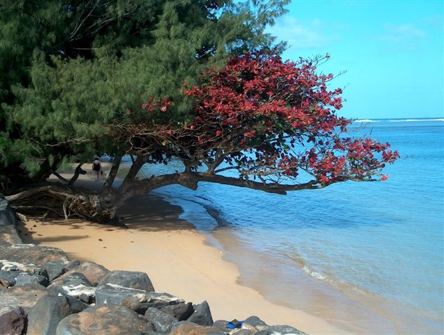
 Crooked trees
 Love Park
 The statue "El Beso" (The Kiss)
from Victor Delfín. It shows two lovers united in an intimate kiss.
The statue "El Beso" (The Kiss)
from Victor Delfín. It shows two lovers united in an intimate kiss.
 Para-gliding
 Para-gliding
With the intended purpose of having the elite clergymen (who
politically governed several valleys in the area) express their complete
religious power and ability to control the use of all the natural water
resources (saltwater and freshwater) of the zone, a Great Pyramid was
constructed in the Huaca.
— at Huaca Pucllana, Lima Perú.